First time ever NHC forecasts a tropical depression to become a category-4 hurricane before being named...
- The intensity forecast for the next five days carries higher than average confidence that Lee will be a major hurricane by Saturday, with some models suggesting category-5 strength by end of the weekend possible. Well above average sea surface temperatures and ocean heat content along the path are reasons for the higher than average confidence.
- Growing confidence of Lee steering clear of the Caribbean: Model guidance continues to be steady in projecting Lee tracking past the Caribbean at a comfortable distance to avoid hurricane force winds. However, large swells, tropical storm force gusts and potential storm surge is possible on north facing shorelines given the relatively close approach at major hurricane strength.
- Any Longer Term Thoughts? Beyond five days, the range of forecast outcomes diverge significantly. Models indicate Lee will slow in forward speed into early next week, raising uncertainty of how far west the hurricane will be before turning to the north. A trough moving across eastern North America, the strength of the North Atlantic ridge, and potentially another tropical system Margo will all play a role in the ultimate path. These three features, and how they interact, will be key to the ultimate track and intensity of Lee later next week.
- Beware of Media Hype: While social media and news outlets will discuss individual model forecasts that depict Northeast US or Canada landfall scenarios, it is simply too early to discuss any specific scenario for North America, even with low confidence. However, if Lee were to ultimately bring impacts to the Northeast US or Canada, the earliest this would transpire is Friday-Saturday September 15-16, and is highly dependent on the timing of the turn to the north and the ultimate steering patterns. Patience is required given large forecast errors, particularly in this set of circumstances, for the final outcome to be determined.

Official NHC track and intensity forecast for Lee. Higher than average oceanic heat content increases confidence of rapid intensification into a major category-3 hurricane by Friday and category-4 strength over the weekend. Source: Tomer Burg / University of Oklahoma.

Probability of sustained winds in excess of 58 mph through the next five days. Lee looks to track far enough away from the northeastern Caribbean to result in minimal wind impacts. Source: NHC.

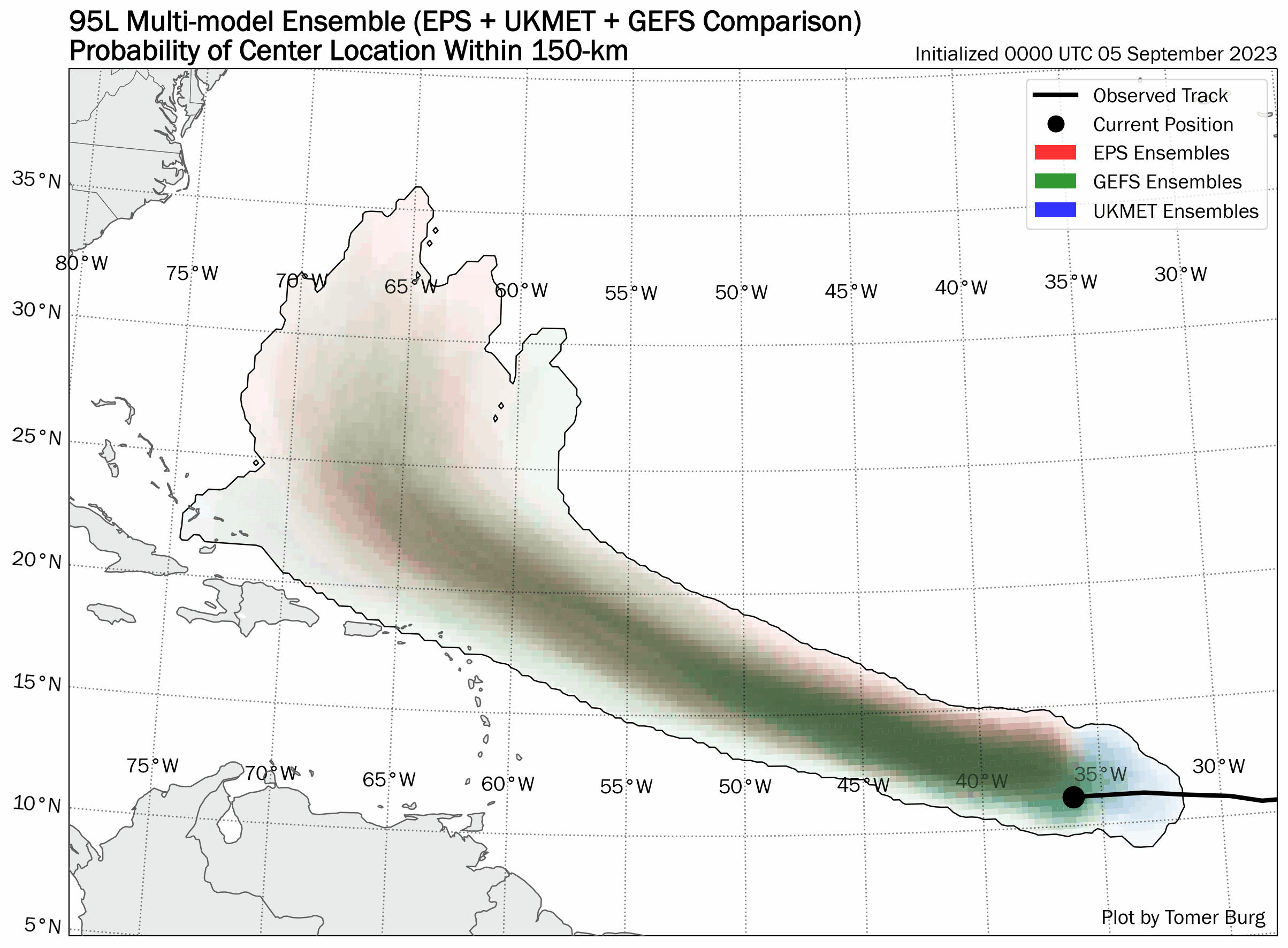
After five days, the forecast spread from the European Ensemble indicates lack of confidence in outcomes into next week (click image for animation of last four model runs of all ensembles for the last two days). Source: WeatherNerds.org.

Multiple factors will ultimately dictate the longer term path of Lee: #1, the timing of an upper level trough of low pressure moving through the eastern US early next week along with #2, the strength of the ridge over the Northern Atlantic will determine timing and westward extent of Lee. A wildcard in the pattern is #3, the next potential storm in the Atlantic, Margot, which may influence the path of Lee as well as the strength of the Atlantic ridge